Saturday, February 9, 2019

(74).Staying safe in an earthquake.

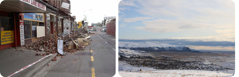
How can you prepare for an earthquake?
If you live in earthquake country, the actions you take before, during, and after a quake could make the difference in your comfort for several days, or even your survival.
Protecting Yourself in an Earthquake
There are many things you can do to protect yourself before, during, and after an earthquake.
Before the Earthquake
Have an engineer evaluate the house for structural integrity. Make sure the separate pieces—floor, walls, roof, and foundation—are all well-attached to each other.

Bracket or brace brick chimneys to the roof.

Be sure that heavy objects are not stored in high places.

Secure water heaters all around and at the top and bottom.

Bolt heavy furniture onto walls with bolts, screws, or strap hinges.

Replace halogen and incandescent light bulbs with fluorescent bulbs to lessen fire risk.

Check to see that gas lines are made of flexible material so that they do not rupture. Any equipment that uses gas should be well-secured.

Everyone in the household should know how to shut off the gas line.

Prepare an earthquake kit with three days supply of water and food, a radio, and batteries.

Place flashlights all over the house and in the glove box of your car.

Keep several fire extinguishers around the house to fight small fires.

Be sure to have a first aid kit. Everyone should know basic first aid and CPR.

Plan in advance how you will evacuate and where you will go. Do not plan on driving, as roadways will likely be damaged.

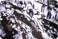
During the Earthquake
If you are in a building, get beneath a sturdy table, cover your head, and hold on.

Stay away from windows, mirrors, and large furniture.

If the building is structurally unsound, get outside as fast as possible.

If you are outside, run to an open area away from buildings and power lines that may fall.

If you are in a car, stay in the car and stay away from structures that might collapse, such as overpasses, bridges, or buildings.

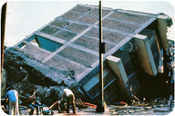
After the Earthquake
Be aware that aftershocks, smaller quakes that come after the main trembler, are likely.

Avoid dangerous areas like hillsides that may experience a landslide.

Turn off water and power to your home.

Call 911 only if there is a real emergency. Many people will be trying to get through to emergency services.

Be prepared to wait for help or instructions. Assist others as necessary.

Summary
Before an earthquake, be sure that your home is secure. Be sure that you have supplies to last a few days.

During an earthquake, get to a safe place.

After an earthquake, avoid dangerous situations, wait for instructions, and assist as necessary.

(74).Earthquake safe structure.

Why is California Memorial Stadium called a "tectonic time bomb"?
The California Memorial Stadium is the home of football at the University of California, Berkeley. The site probably looked flat and easy to build on in 1922. But now scientists know that the Hayward Fault passes directly beneath both end zones. The stadium has been renovated in a $321 million project. The renovation involved 10 miles of steel cables, silicone fluid-filled shock absorbers, concrete piers, 3-feet of sand, plastic sheeting, and stone columns. Go Bears!
New Construction
New construction can be made safer in many ways:
Skyscrapers and other large structures built on soft ground must be anchored to bedrock. Sometimes the bedrock lies hundreds of meters below the ground surface.

The correct building materials must be used. Houses should bend and sway. Wood and steel are better than brick, stone, and adobe, which are brittle and will break.

Larger buildings must sway, but not so much that they touch nearby buildings. Counterweights and diagonal steel beams are used to hold down sway.

Large buildings can be placed on rollers so that they move with the ground.

Buildings may be placed on layers of steel and rubber to absorb the shock of the waves.

Connections, such as where the walls meet the foundation, must be made strong.

In a multi-story building, the first story must be well supported.

The Transamerica Building in San Francisco, pictured below, rests on a 52-foot deep steel and concrete foundation. Steel rods reinforce the building internally and X-shaped trusses support it externally. In the 1989 Loma Prieta earthquake, the building shook for more than a minute and swayed more than 12 inches in each direction, but was not damaged.
[Figure 1]
The Transamerica Pyramid in San Francisco is more stable in an earthquake or in high winds than a rectangular skyscraper.
Retrofitting
Older buildings can be made more earthquake safe by retrofitting. Steel or wood can be used to reinforce a building's structure and its connections. Elevated freeways and bridges can also be retrofitted so that they do not collapse (Figure below).
[Figure 2]
This bridge in San Diego, California, was built in 1931. It was retrofitted and reopened in 2010 to meet earthquake standards.
Preventing Fire Damage
Fires often cause more damage than the earthquake. Fires start because seismic waves rupture gas and electrical lines. Breaks in water mains make it difficult to fight the fires (Figure below). The shapes of pipes can make a big difference. Straight pipes will break in a quake. Builders zigzag pipes so that they bend and flex when the ground shakes. In San Francisco, water and gas pipelines are separated by valves. Areas can be isolated if one segment breaks.
[Figure 3]
In the 1906 San Francisco earthquake, fire was much more destructive than the ground shaking.
Making Choices
Strong, sturdy structures are expensive to build. Communities must decide how safe to make their buildings. They must weigh how great the hazard is, what different building strategies will cost, and how much risk they are willing to take.
Summary
New structures that are built to meet earthquake safety codes do much better in earthquakes.

Old buildings can be retrofitted for better safety.

Cost is an important factor in deciding how safe to make the structures in an area.

(73).Earthquake damage.

Is earthquake magnitude the most important factor in determining damage?
The type of construction has a tremendous effect on what happens during an earthquake. Damage and deaths are directly affected by the construction in an earthquake. For example, enormous damage was done in the 2011 Christchurch, New Zealand earthquake. However, far less was damaged in an earthquake of the same magnitude near the area in Iceland seen above.
Damage from Earthquakes
We know that earthquakes kill lots of people. However, the ground shaking almost never kills people. Unlike in cartoons, the ground does not swallow someone up! Deaths depend somewhat on an earthquake's size and the type of ground people inhabit. But a very important factor is the quality of the structures. People are killed when structures fall on them. More damage is done and more people are killed by the fires that follow an earthquake. Of course, the number of deaths is different from the property damage that a quake does.
What Makes Earthquakes Deadly?
What makes an earthquake deadly?
Population density. The magnitude 9.2 Great Alaska Earthquake, near Anchorage, of 1964 resulted in only 131 deaths. At the time few people lived in the area (Figure below).

[Figure 1]
A landslide in a neighborhood in Anchorage, Alaska, after the 1964 Great Alaska earthquake.
Size, but not size. No one dies in a magnitude 1.0 earthquake. But large quakes to not always kill a lot of people. Only about 2,000 people died in the 1960 Great Chilean earthquake. This was the largest earthquake ever recorded. The Indian Ocean earthquake of 2004 was one of the largest ever. Still, most of the 230,000 fatalities were caused by the tsunami, not the earthquake.

Ground type. Solid bedrock vibrates less than soft sediments, so there is less damage on bedrock. Sometimes sediments become saturated with water. They then undergo liquefaction and become like quicksand (Figure below). Soil on a hillside may become a landslide.

[Figure 2]
Liquefaction of sediments in Mexico City caused the collapse of many buildings in the 1985 earthquake.
City Planning
In earthquake-prone areas, city planners try to reduce hazards. They look at both the likelihood of a quake and the damage one would do. For example, in the San Francisco Bay Area, maps show how much shaking is expected for different ground types (Figure below). This allows planners to locate new hospitals and schools more safely.
[Figure 3]
The expected Modified Mercalli Intensity Scale for an earthquake of magnitude 7.1 on the northern portion of the Hayward Fault.

Summary
Seismic waves rarely kill anyone. Structures falling on people and fires or tsunamis after the earthquake cause many more fatalities.

City planning can lessen the damage done by earthquakes.

Population density and ground type affect the number of fatalities.

(72).Predicting esrthquake.

What if you could predict an earthquake?
What would make a good prediction? Knowing where, when, and the magnitude of the quake would make it possible for people to evacuate. If you were right, you would be famous! But if you were wrong, many people would be angry with you.
Earthquake Prediction
Scientists are a long way from being able to predict earthquakes. A good prediction must be detailed and accurate. Where will the earthquake occur? When will it occur? What will be its approximate magnitude? With a good prediction, authorities could get people to evacuate. But if the prediction were wrong, a lot of money would be lost as people closed businesses and skipped work. Plus people would be unlikely to believe the authorities the next time.
Predicting Where
Where an earthquake will occur is the easiest feature to predict. How would you predict this? Scientists know that earthquakes take place at plate boundaries. They tend to happen where they’ve happened before (Figure below).
[Figure 1]
This map shows earthquake probability regions in the United States.
Fault segments behave consistently. A segment with frequent small earthquakes will likely continue to have frequent small earthquakes. A fault segment with infrequent huge earthquakes will likely have infrequent huge earthquakes. The image below shows the probabilities of earthquakes striking along various faultsin the San Francisco area (Figure below). The time frame is between 2003 (when the work was done) and 2032.
[Figure 2]
The probabilities of earthquakes striking along various faults in the San Francisco area between 2003 (when the work was done) and 2032.
Predicting When
When an earthquake will occur is much more difficult to predict. Stress on a fault builds up at the same rate over time. So earthquakes should occur at regular intervals. But, so far, scientists cannot predict when quakes will occur even to within a few years. Around Parkfield, California, an earthquake of magnitude 6.0 or higher occurs about every 22 years. So seismologists predicted that one would strike in 1993. But that quake came in 2004—11 years late (Figurebelow).
[Figure 3]
Trying to predict an earthquake in Parkfield, California.
Earthquake Signs
There are sometimes signs that a large earthquake is coming. There may be small quakes, called foreshocks. These can occur a few seconds to a few weeks before a major quake. Unfortunately, foreshocks are not very useful for predicting large earthquakes. Many quakes do not have foreshocks. Also, small earthquakes are not necessarily followed by a large earthquake.
There are other possible signs before an earthquake. The ground may tilt. Ground tilting is caused by the buildup of stress in the rocks. This may happen before a large earthquake, but it doesn't always. Water levels in wells may fluctuate. This is because water may move into or out of fractures before an earthquake. This is also an uncertain way to predict an earthquake. The difference in arrival times of P-waves and S-waves may decrease just before an earthquake occurs.
Folklore tells of animals behaving strangely just before an earthquake. Most people tell stories of these behaviors after the earthquake. Chinese scientists have actively studied the behavior of animals before earthquakes to see if there is a connection. So far nothing concrete has come of these studies.
Actions can reduce the damage once an earthquake has started. Seismometers can detect P-waves a few seconds before more damaging S-waves and surface waves arrive. In this time computers can shut down gas mains and electrical transmission lines. They can initiate protective measures in chemical plants, nuclear power plants, mass transit systems, airports, and roadways. Just a few seconds can be tremendously valuable.
Summary
A good prediction must indicate when and where an earthquake will take place.

Fault segments behave the same way over time.

Signs that an earthquakes may occur include foreshocks, ground tilting, water levels in wells, and the relative arrival times of P- and S-waves.

(71).Earthquake magnitude scale

How do scientists measure earthquakes?
This 8.8 magnitude earthquake in Chile in 2010 caused over 500 deaths and thousands of injuries. Earthquakes and the damage they cause can be measured in a few different ways. One way is to describe the damage. The other way is to measure the energy of the quake.
Earthquake Intensity
The ways seismologists measure an earthquake have changed over the decades. Initially, they could only measure what people felt and saw: the intensity. For this, they used the Mercalli scale.
Mercalli Scale
Early in the 20th century, earthquakeswere described in terms of what people felt and the damage that was done to buildings. The Mercalli intensity scaledescribes earthquake intensity.
There are many problems with the Mercalli scale. The damage from an earthquake is affected by many things. The type of ground a building sits on is very important to what happens to that building in a quake. Different people experience an earthquake differently. Using this scale, comparisons between earthquakes were difficult to make. A new scale was needed.
Earthquake Magnitude
For decades scientists have had equipment that can measure earthquake magnitude. The earthquake magnitude is the energy released during the quake.
The Richter Magnitude Scale
Charles Richter developed the Richter magnitude scale in 1935. The Richter scale measures the magnitude of an earthquake's largest jolt of energy. This is determined by using the height of the waves recorded on a seismograph.
The Richter scale is logarithmic. The magnitudes jump from one level to the next. The height of the largest wave increases 10 times with each level. So the height of the largest seismic wave of a magnitude 5 quake is 10 times that of a magnitude 4 quake. A magnitude 5 is 100 times that of a magnitude 3 quake. With each level, thirty times more energy is released. A difference of two levels on the Richter scale equals 900 times more released energy.
The Richter scale has limitations. A single sharp jolt measures higher on the Richter scale than a very long intense earthquake. Yet, this is misleading because the longer quake releases more energy. Earthquakes that release more energy are likely to do more damage. As a result, another scale was needed.
The Moment Magnitude Scale
The moment magnitude scale is the favored method of measuring earthquake magnitudes. It measures the total energy released by an earthquake. Moment magnitude is calculated by two things. One is the length of the fault break. The other is the distance the ground moves along the fault. Japan's Tōhoku earthquake in 2011 had a magnitude of 9.0 (Figure below).
[Figure 1]
Earthquake and tsunami damage in Japan, 2011. The Tōhoku earthquake had a magnitude of 9.0.
Summary
Mercalli Intensity Scale depends on many factors other than the amount of energy released in the earthquake. These factors include the type of rock in the region. They also include the quality of the structures built in the area.

The Richter scale is a logarithmic scale that measures the largest jolt of energy released by an earthquake.

The moment magnitude scale is a logarithmic scale that measures the total amount of energy released by an earthquake.

(70).Locating eathquake epicenters.

Can you find an earthquake epicenter?
The epicenter of the 2011 Japan earthquake was just offshore of Sendai. This is where the Pacific Plate plunges into a subduction zone. The earthquake had a relatively shallow depth of 20 miles (32 km). Remember that shallow quakes typically cause the most damage. How do scientists find an earthquake epicenter?
Finding the Epicenter
One seismogram indicates the distanceto the epicenter. This is determined by the P-and S-wave arrival times. If a quake is near the seismograph, the S-waves arrive shortly after the P-waves. If a quake is far from the seismograph, the P-waves arrive long before the S-waves. The longer the time is between the P-and S-wave arrivals, the further away the earthquake was from the seismograph. First, seismologists calculate the arrival time difference. Then they know the distance to the epicenter from that seismograph. They can connect all the points that are that distance from the seismic station. This makes a circle around the station!
Next, the seismologists try to determine the location of the earthquake epicenter. To do this they need the distances to the epicenter from at least three seismographs. Let’s say that they know that an earthquake’s epicenter is 50 kilometers from Kansas City. They draw a circle with a 50 km radius around that seismic station. They do this twice more around two different seismic stations. The three circles intersect at a single point. This is the earthquake’s epicenter (Figure below).
[Figure 1]
Seismographs in Portland, San Francisco, and Salt Lake City are used to find an earthquake epicenter.

Summary
To find an earthquake epicenter you need at least three seismographs.

Find the distance from each seismograph to the earthquake epicenter.

The interception of the three circles is the epicenter.

(69).Measuring earthquake magnitude.

Have you ever felt an earthquake?
Small earthquakes are fairly common in some parts of the world. Depending on the quake, the land, and the setting, people experience them differently. You may wonder why your chair is moving, when you are sitting still. You may think someone is running across the roof. In a skyscraper, you may be swaying. Seismometers quantify this and record the energy released in the quake.
Measuring Seismic Waves
Seismic waves are measured on a seismograph. Seismographs contain a lot of information, and not just about earthquakes.
Seismometers
seismograph is a machine that records seismic waves. In the past, seismographs produced a seismogram. A seismogram is a paper record of the seismic waves the seismograph received. Seismographs have a weighted pen suspended from a stationary frame. A drum of paper is attached to the ground. As the ground shakes in an earthquake, the pen remains stationary but the drum moves beneath it. This creates the squiggly lines that make up a seismogram (Figurebelow).
[Figure 1]
This seismograph records seismic waves.
Modern seismometers record ground motions using electronic motion detectors. The data are then kept digitally on a computer.
What We Learn from Seismograms
Seismograms contain a lot of information about an earthquake: its strength, length, and distance. Wave height is used to determine the magnitude of the earthquake. The seismogram shows the different arrival times of the seismic waves (Figure below). The first waves are P-waves since they are the fastest. S-waves come in next and are usually larger than P-waves. The surface waves arrive just after the S-waves. If the earthquake has a shallow focus, the surface waves are the largest ones recorded.
[Figure 2]
These seismograms show the arrival of P-waves and S-waves.
A seismogram may record P-waves and surface waves, but not S-waves. This means that it was located more than halfway around the Earth from the earthquake. What does that mean? Earth's outer core is liquid. S-waves cannot travel through liquid. So the liquid outer core creates an S-wave shadow zone on the opposite side of the Earth from the quake.
Like most things, seismographs are now digital. Information from seismic waves is fed into computers at seismic stations around the world.


Further Reading 
Summary
A seismograph records seismic waves on a seismogram. A seismometer is a digital seismic wave recorder.

S-waves do not travel through liquids. So a seismogram with no S-waves is on the other side of the planet from the quake.

Seismographs yield a tremendous amount of information about an earthquake.

(68).21st century tsunami.

Why should you pay attention in school?
Eleven-year-old Tilly Smith and her family were walking along the beach in Phuket, Thailand, on December 26, 2004. Tilly noticed that the sea was bubbling. She thought this was like a video she'd seen in geography class two weeks earlier. The English schoolgirl insisted to her parents that a tsunami was coming. Her warning saved the approximately 100 tourists and civilians who were on that beach.
Earthquakes can cause tsunamis. These deadly ocean waves may result from any shock to ocean water. A shock could be a meteorite impact, landslide, or a nuclear explosion. But most come from large underwater earthquakes.
An underwater earthquake creates a tsunami this way: the movement of the crust displaces water. The displacement forms a set of waves. The waves travel at jet speed through the ocean. Since the waves have low amplitudes and long wavelengths, they are unnoticed in deep water. As the waves reach shore they compress. They are also pushed upward by the shore. For these reasons, tsunamis can grow to enormous wave heights. Tsunami waves can cause tremendous destruction and loss of life. Fortunately, few undersea earthquakesgenerate tsunamis.
The Boxing Day Tsunami, 2004
The Boxing Day Tsunami struck on December 26, 2004. The tsunami was caused by one of the largest earthquakes ever recorded. The Indian Ocean Earthquake registered magnitude 9.1. The quake struck near Sumatra, Indonesia, where the Indian plate is subducting beneath the Burma plate. It released about 550 million times the energy of the atomic bomb dropped on Hiroshima.
Several tsunami waves were created. The waves went around the Indian Ocean and struck eight countries (Figurebelow).
[Figure 1]
Travel time map for the Boxing Day Tsunami (in hours). Countries near red, orange, and yellow areas were affected the most.
About 230,000 people died. More than 1.2 million people lost their homes. Many more lost their way of making a living. Fishermen lost their boats, and businesspeople lost their restaurants and shops. Many marine animals washed onshore, including dolphins, turtles, and sharks.
Japan Tsunami, 2011
The Japanese received a one-two punch in March 2011. The 2011 Tōhoku earthquake offshore was a magnitude 9.0, and damage from the quake was extensive. The earthquake generated massive tsunami waves which hit the island nation. Waves in some regions topped 9 meters (27 feet).
The tsunami did much more damage than the massive earthquake. In the photo of Sendai (Figure below), the black smoke is coming from an oil refinery. The refinery was set on fire due to the earthquake. The tsunami prevented efforts to extinguish the fire for several days.
[Figure 2]
An aerial view shows the damage to Sendai, Japan caused by the earthquake and tsunami.
Worst of all was the damage done to nuclear power plants along the northeastern coast. Eleven reactors were automatically shut down. Power and backup power were lost at the Fukushima plant. This lead to equipment failures, meltdowns, and the release of radioactive materials. Cleanup of the disabled plants will go on for many years.
Tsunami Warning Systems
Most of the Indian Ocean tragedy could have been avoided if a warning system had been in place (Figure below). As of June 2006, the Indian Ocean now has a warning system. Communities around the Pacific have had a tsunami warning system since 1948.
[Figure 3]
This sign is part of the tsunami warning system used in communities around the Pacific Ocean since 1948.
As in Japan, warning systems aren’t always helpful. People in communities very close to the earthquake do not have enough time to move out of the area. Farther away from the quake, evacuation of low-lying areas saves lives.
Summary
Tsunamis have relatively low amplitude and long wavelengths. They are not noticeable until they move up a shore.

Tsunami warning systems are now found in most locations where tsunamis are possible.

The Boxing Day Tsunami of 2004 came from a massive earthquake. The waves traveled across the Indian Ocean, causing death and destruction in 12 nations.

In Japan, the tsunami struck very quickly after the 9.0 earthquake in the subduction zone offshore. Many more people died from the tsunami than the quake.

(68).Seismic waves.

Are seismic waves like ocean waves?
Yes, in some ways. Ocean waves travel at the interface between the sea surface and the atmosphere. They have all the features that all waves have. Some seismic waves also travel at an interface. Which ones?
Seismic Waves
Seismic waves are the energy from earthquakes. Seismic waves move outward in all directions away from their source. Each type of seismic wave travels at different speeds in different materials. All seismic waves travel through rock, but not all travel through liquid or gas. Geologists study seismic waves to learn about earthquakes and the Earth’s interior.
Wave Structure
Seismic waves are just one type of wave. Sound and light also travel in waves. Every wave has a high point called a crest and a low point called a trough. The height of a wave from the center line to its crest is its amplitude. The horizontal distance between waves from crest to crest (or trough to trough) is its wavelength (Figure below).
[Figure 1]
The energy from earthquakes travels in waves, such as the one shown in this diagram.
Types of Seismic Waves
There are two major types of seismic waves. Body waves travel through the Earth’s interior. Surface waves travel along the ground surface. In an earthquake, body waves are responsible for the sharp jolts. Surface waves are responsible for the rolling motions that do most of the damage in an earthquake.
Body Waves
Primary waves (P-waves) and secondary waves (S-waves) are the two types of body waves (Figure below). Body waves move at different speeds through different materials.
P-waves are faster. They travel at about 6 to 7 kilometers (about 4 miles) per second. Primary waves are so named because they are the first waves to reach a seismometer. P-waves squeeze and release rocks as they travel. The material returns to its original size and shape after the P-wave goes by. For this reason, P-waves are not the most damaging earthquake waves. P-waves travel through solids, liquids, and gases.
S-waves are slower than P-waves. They are the second waves to reach a seismometer. S-waves move up and down. They change the rock’s shape as they travel. S-waves are about half as fast as P-waves, at about 3.5 km (2 miles) per second. S-waves can only move through solids. This is because liquids and gases don’t resist changing shape.
[Figure 2]
P-waves and S-waves are the two types of body waves.
Surface Waves
[Figure 3]
Love waves and Rayleigh waves are the two types of surface waves.
Surface waves travel along the ground outward from an earthquake’s epicenter. Surface waves are the slowest of all seismic waves. They travel at 2.5 km (1.5 miles) per second. There are two types of surface waves. Love waves move side-to-side, much like a snake. Rayleigh waves produce a rolling motion as they move up and backward (Figure above). Surface waves cause objects to fall and rise. They also cause objects to sway back and forth. These motions cause damage to rigid structures during an earthquake.
Summary
Body waves travel through the body of a planet. Surface waves travel along the surface.

There are two types of body waves: P-waves travel fastest and through solids, liquids, and gases; S-waves only travel through solids.

Surface waves are the slowest, but they do the most damage in an earthquake.

(67).Intraplate earthquakes.

When can you go up in the Washington Monument again?
An earthquake in August 2011 in Virginia cracked the top of the Washington Monument. After 32 months of repair, the monument reopened to the public. Other sites in Washington, D.C., like the National Cathedral, were also damaged.
Intraplate Earthquakes
About 5% of earthquakes take place within a plate, away from plate boundaries. These intraplate earthquakes are caused by stresses within a plate. Since plates move over a spherical surface, zones of weakness are created. Intraplate earthquakes happen along these zones of weakness. The earthquakes may take place along ancient faults or rift zones.
2011 Virginia Earthquake
In August 2011, the eastern seaboard of the U.S. was rocked by a magnitude 5.8 earthquake. While not huge, most of the residents had never experienced an earthquake. Many didn't know what had happened!
This region is no longer part of an active plate boundary. But a few hundred million years ago, at the end of the Paleozoic, things were different. Continent-continent convergence was bringing Pangaea together. This region was being uplifted into the ancestral Appalachian mountains. There are still ancient faults that sometimes reactivate.
New Madrid Earthquake
In 1812, a magnitude 7.5 earthquake struck near New Madrid, Missouri. The earthquake was strongly felt over approximately 50,000 square miles. The quake even altered the course of the Mississippi River. Because very few people lived in the area at the time, only 20 people died. Many more people live there today (Figure below). A similar earthquake today would undoubtedly kill many people and cause a great deal of property damage. The New Madrid Seismic Zone continues to be active.
[Figure 1]
The New Madrid seismic zone is located in the interior of the North American plate (near Missouri, Arkansas, Tennessee, Kentucky, and Illinois).
Summary
Intraplate earthquakes occur because solid lithosphere travels on a round planet.

Intraplate earthquakes hit reactivated ancient faults.

Intraplate earthquakes are not usually as large as quakes along plate boundaries. Still, they can do a great deal of damage.

(66).Earthquake at convergent boundaries.

What damage is done to people's lives by earthquakes?
In a large earthquake hundreds or thousands of people may die. Many more may lose their homes and livelihoods. After a large quake, the world's attention turns to help the victims. But soon there is another disaster in the news, and the world's attention turns. People may be left homeless due to an earthquake for many years.
Convergent Plate Boundaries
Earthquakes at convergent plate boundaries mark the location of the subducting lithosphere. The motion of the lithosphere as it plunges through the mantle causes the quakes (Figurebelow). At greater depths, the plate heats up enough to deform plastically.
[Figure 1]
A cross section of earthquake epicenters. The depth outlines the subducting plate. There are shallow, intermediate, and deep earthquakes.
Convergent plate boundaries produce earthquakes most of the way around the Pacific Ocean basin.
Ocean-Ocean: Japan
Earthquakes in Japan are caused by ocean-ocean convergence. In this part of the Pacific Ocean, oceanic crust subducts beneath oceanic crust. This creates as many as 1,500 earthquakes every year.
In March 2011, the 9.0 magnitude Tōhoku earthquake struck off of northeastern Japan. Damage from the quake was severe. Even more severe was the damage from the tsunami generated by the quake (Figure below and Figurebelow). A tsunami is an enormous ocean wave or set of waves generated by an underwater earthquake. In all, 25,000 people were known dead or missing.
[Figure 2]
The damage in Miyako, Iwate, Japan after a 9.0 magnitude earthquake and the massive tsunami it generated struck in March, 2011.
[Figure 3]
Destruction in Ofunato, Japan, from the 2011 Tōhoku Earthquake.
Ocean-Continent: Cascades
The Pacific Northwest of the United States is at risk from a potentially massive earthquake. The subduction of three small plates beneath North America produces active volcanoes, the Cascades. The region also experiences earthquakes. However, large earthquakes only hit every 300 to 600 years. The last was in 1700. That quake had an estimated magnitude of around 9. A quake of that magnitude today could produce an incredible amount of destruction and untold fatalities. 
Continent-Continent: Asia
The collision of two continents also creates massive earthquakes. Many earthquakes happen in the region in and around the Himalayan Mountains. The 2001 Gujarat, India, earthquake is responsible for about 20,000 deaths, with many more people injured or made homeless (Figure below).
[Figure 4]
Damage from the 2005 Kashmir earthquake.


Summary
Earthquakes occur all along the subducting plate as it plunges into the mantle.

All three types of convergent plate boundaries produce massive earthquakes.

Subduction zones around the Pacific Rim are responsible for many of the world's earthquakes.

(65).Earthquake at transform plate boundaries.

What does the future of San Francisco hold?
The last large earthquake along the San Andreas Fault in the San Francisco area stuck in 1906. The city was devastated. Studies show that big quakes occur every 125 years or more. Small quakes seem to precede large ones, and there have been some small ones in recent years. What do you think the future holds for San Francisco?
Transform plate boundaries produce enormous and deadly earthquakes. These quakes at transform faults are shallow focus. This is because the plates slide past each other without moving up or down.
The San Andreas Fault that runs through much of California is an enormous transform plate boundary. It is the plate boundary between Pacific and North American plates. The largest earthquake in recorded history on the San Andreas Fault occurred in 1906. The quake's epicenter was just north of in San Francisco. About 3,000 people died and 28,000 buildings were lost, mostly in the fire that followed the earthquake.
There are many other faults spreading off the San Andreas, to take up the plate motion. In total the San Andreas Fault system produces around 10,000 earthquakes a year (Figure below). While most of those earthquakes cannot even be felt by people nearby, occasionally one is very strong. In the San Francisco Bay Area, the Hayward Fault was the site of a magnitude 7.0 earthquake in 1868.
[Figure 1]
The San Andreas Fault runs through the San Francisco Bay Area. Other related faults cross the region. Lines indicate strike slip faults. Lines with hatches are thrust faults.
Other significant earthquakes in California include the 1989 Loma Prieta earthquake near Santa Cruz (Figurebelow) and the 1994 Northridge earthquake near Los Angeles.
[Figure 2]
Three people died in this mall in Santa Cruz during the 1989 Loma Prieta earthquake.
Although California is prone to many natural hazards, including volcanic eruptions at Mt. Shasta or Mt. Lassen, and landslides on coastal cliffs, the natural hazard the state is linked with is earthquakes. In this video, the boundaries between three different tectonic plates and the earthquakes that result from their interactions are explored.
New Zealand also has a transform fault with strike-slip motion, causing about 20,000 earthquakes a year! Only a small percentage of those are large enough to be felt. A 6.3 quake in Christchurch in February 2011 killed about 180 people.
Summary
Transform fault earthquakes have shallow focus because the plates meet near the surface.

The San Andreas Fault is actually a fault zone made up of a number of other active faults.

New Zealand also has a transform plate boundary.

Review
Why are earthquakes at transform plate boundaries always shallow focus?

Why are there so many small faults in the San Francisco Bay Area?

Why do such large earthquakes take place along the San Andreas Fault?

(64).Earthquake zone

What caused the 2010 earthquake in Angol, Chile?
Angol, Chile, experienced a huge 8.8 magnitude earthquake in February 2010. The earthquake was due to subduction of the Nazca plate beneath South America. This subduction zone is part of the Pacific Ring of Fire.
Annual Earthquakes
In a single year, on average, more than 900,000 earthquakes are recorded. About 150,000 of them are strong enough to be felt. Each year about 18 earthquakes are major, with a Richter magnitude of 7.0 to 7.9, and on average one earthquake has a magnitude of 8 to 8.9.
Magnitude 9 earthquakes are rare. The United States Geological Survey lists five since 1900 (Figure below and Tablebelow). All but the Great Indian Ocean Earthquake of 2004 occurred somewhere around the Pacific Ocean basin.
[Figure 1]
The 1964 Good Friday Earthquake centered in Prince William Sound, Alaska released the second most amount of energy of any earthquake in recorded history.
LocationYearMagnitudeValdivia, Chile19609.5Prince William Sound, Alaska19649.2Great Indian Ocean Earthquake20049.1Kamchatka, Alaska19529.0Tōhoku, Japan20119.0
Earthquake Zones
Nearly 95% of all earthquakes take place along one of the three types of plate boundaries.
About 80% of all earthquakes strike around the Pacific Ocean basin because it is lined with convergent and transform boundaries (Figurebelow). The region around the Pacific is called the Pacific Ring of Fire due to its earthquakes and volcanoes.

About 15% take place in the Mediterranean-Asiatic Belt. Convergence is causing the Indian Plate to run into the Eurasian Plate.

The remaining 5% are scattered around other plate boundaries. A few earthquakes take place away from plate boundaries. These are intraplate earthquakes.

[Figure 2]
Earthquake epicenters for magnitude 8.0 and greater events since 1900. The earthquake depth shows that most large quakes are shallow focus, but some subducted plates cause deep focus quakes.
Summary
Small earthquakes are extremely common, but the largest earthquakes are extremely rare.

The vast majority of earthquakes happen at plate boundaries.

The Pacific Ocean basin has the most earthquakes due to convergent and transform plate boundaries. The Himalaya region has the second most due to the convergence of India and Asia.


Earth science

(2).Introduction to earth science